2nd Hand Equipment - Coming soon!

We are now putting the final touches to the World Mining Equipment 2nd Hand market place. If you would like information on this service contact


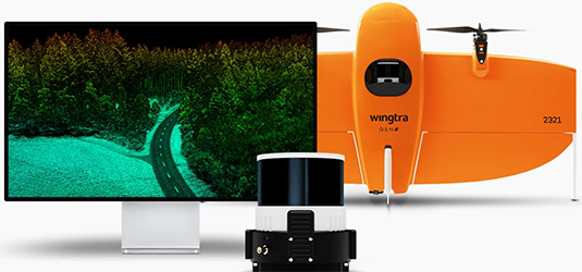
Wingtra has announced the launch of its LIDAR drone solution, which it says is a significant advancement in drone LIDAR technology. The new Wingtra LIDAR payload integrates the features of WingtraOne GEN II drones with the new LIDAR sensor.
“We’re excited to deliver a LIDAR drone mapping solution to our customers, which we’re confident will exceed their expectations, cut their costs and headaches, and win them more bids. We’re already seeing our first customers comment how surprisingly easy it is to set up, fly and generate a high-quality point cloud. And as always, we keep our promise with the data: high-precision, reliable and repeatable.” said Julian Mackern, Product Manager at Wingtra.
Wingtra LIDAR offers 3 cm (1.2 in) vertical accuracy; the company says customers report this as being top of the range from a 60m(200ft) flight height. Point density is top of its class and the WingtraOne GENII’s design and automated flight pattern ensure consistency across different pilots.
For more information: https://wingtra.com/mapping-drone-wingtraone/drone-sensors/lidar/